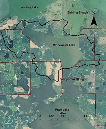
Minnewasta Lake receives most of its water from groundwater discharged from the surrounding Waubay Aquifer. Its small watershed is comprised mainly of cropland and the lakes water quality is highly influenced by direct runoff from shoreline activities. Minnewasta Lake is located in central Day County.
Minnewasta Lake
Maximum Depth: 14 feet
Mean Depth: 10.5 feet
Lake Volume: 6,310 acre-ft
Surface Area: 601 acres
Shoreline Length: 5.5 miles
Watershed Acres: 2,564 acres
Warm Water Permanent Fisheries: black bullhead, black crappie, bluegill, common carp, emerald shiner, fathead minnow, Iowa darter, northern pike, orange -spotted sunfish, walleye, white bass, white sucker, yellow perch.
For more information on Minnewasta Lake, click on the following links:
Watershed Map
SD GF&P Lake Contour Map