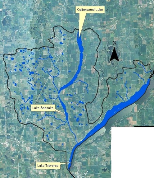
Lake Traverse is located on the Minnesota - South Dakota border. The Lake Traverse project consists of two dams, one dike and two lakes, Traverse and Mud. The main purpose of the project is to control flooding along the northward flowing Bois de Souix River, which joins the Ottertail River to become the Red River of the North. The significant feature of the project is the Browns Valley Dike on the south end of Lake Traverse, keeping it separate from Big Stone Lake. The dike sits on the continental divide, which marks the outlet of Glacial Lake Agassiz. Waters on the north side of the dike flow into Hudson Bay, and on the south, waters flow into the Minnesota River and on to the Mississippi River.
Lake Traverse
Maximum Depth: 12 feet
Mean Depth: 10 feet
Lake Volume: N/A
Surface Area: 11,530 acres
Shoreline Length: N/A
Watershed Acres: 729,005 acres
Major Tributaries: Jim Creek located in South Dakota, Mustinka River located in Minnesota. Oulet flows north into the Bois de Sioux River.
Warm Water Permanent Fisheries: A complete list of fish found in Lake Traverse
can be found at: Fish of Northeast SD.
Watershed Map